Search and rescue in Nepal
Canadian relief agency Global Medic is using UAVs to coordinate its search and rescue efforts overseas. Photo © Creative Commons.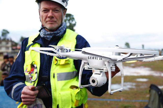
UAVs in disaster zones
Global Medic founder Rahul Singh admits that his passion and expertise lie in providing relief and medical support for people affected by disaster. However, during a relief mission to Port-Au-Prince, Singh realized that his organization would have to modernize its logistics.
“We are the doers,” says Singh. “We deliver the aid and we’re going to do whatever it takes to make the process easier.”
In the time since the 2010 earthquake in Haiti, Global Medic has been using UAVs to support their efforts in delivering aid and support to countries that have been struck by natural disasters. In 2015, Global Medic responded to the devastating earthquake Nepal using quadcopter helicopters to coordinate their disaster response more efficiently.
While the agency has been providing relief for many years, the move towards using UAV technology came only after the logistical issues surfaced in Haiti. Global Medic’s relief workers were driving in a massive, slow moving convoy, and needed clearer roads to get to the places they were needed. However, Port-Au-Prince was a chaotic mess of broken roads, crumbling buildings and rioting mobs after the earthquake. Global Medic couldn’t move through the crowds of people quickly enough to be effective, and finding alternate routes in the field cost them precious time.
“Imagine 20 large vehicles trying to all turn around and work their way through a thick crowd of people all at once,” says Singh.
On top of the damaged infrastructure, aftershocks from the quake caused already fragile buildings to crumble while relief workers were in the field. With their logistical situation changing on a moment by moment basis, it was extremely difficult for Global Medic to plan and allocate resources effectively for their operations. Following their mission to Haiti, Singh and his staff felt that having better awareness of their environment would have increased the effectiveness of their response.
“We felt that it would have been better in that situation to have some sort of imagery of what was going on around us because at that time we were basically operating in cones or vacuums,” says Singh
Developing the tools
When major disasters occur underdeveloped countries, relief agencies like Global Medic can’t be optimally effective because of the damaged infrastructure and communications networks. They don’t always know who needs help where, which roads have been destroyed or where people have been displaced as a result of the disaster. The Global Medic team had emergency facilities ready to administer aid and they had sources of safe water available for the people who needed it, but they didn’t have a full understanding of their surroundings on a moment-by-moment basis.
“If I call 911 and say, ‘I need help’ and then hang up, 911 is stuck. They aren’t going to know who you are or what kind of help you need,” says Singh.
“But if you call and say, ‘Help, I broke my leg’ they know exactly what kinds of resources to send. You’ve triaged the call and know exactly what to send to them.”
Singh and his team realized that better analysis on the ground would improve their ability to administer aid in disaster scenarios. After they finished their mission in Haiti, they went through an evaluation process to figure out which tools they could use to be more effective in their efforts. They felt that if they had a bird’s-eye view coming into the city of which roads were out in front of us then they’d be able to steer that convoy through. This would be a perfect solution to a lot of the issues this team was having in terms of being able to allocate their resources effectively in these scenarios.
“We thought, ‘Wouldn’t it be perfect to have a UAV that could go out ahead of us, and do those sorts of things.’ we thought this application would work in all the other areas where we work,” says Singh.
Air Medic didn’t have the technological expertise to build the UAVs themselves. They specialize in providing relief and emergency response in disaster situations.
“Saving lives is what we do,” says Singh. “We don’t have incredible amounts of funding to be able to develop our own systems. People are giving us money to provide relief.”
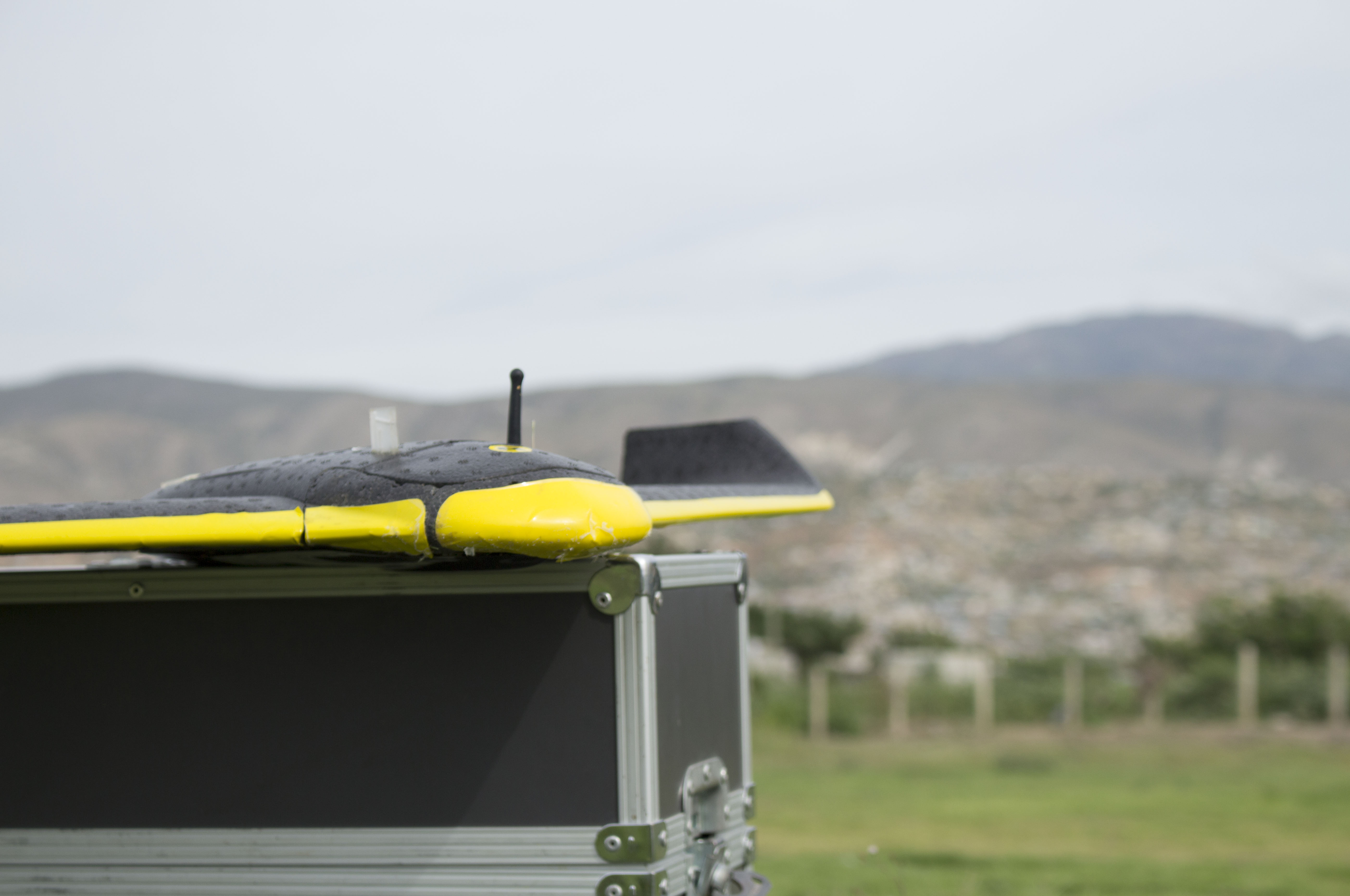
Their lack of experience with UAV technology led them to seek out partnerships with people in the industry to figure out the steps to making their solution a reality. In 2014, Singh and his partners at Global Medic reached out to Aeryon Labs, a Canadian UAV manufacturer based in Waterloo, to talk about developing systems that would meet their needs in the field. In Nepal, the UAVs would have to be able to fly in high winds, survive bird strikes and operate at high altitudes. The UAVs would also require specialized software that would work well with the Chinese satellites Global Medic was using for navigation. Additional software that could create maps using the pictures taken while the UAVs were in the air were also necessary to make the systems effective in the field.
“It’s not as easy as switch it on, send it up, take your pictures and then everything is fine,” says Singh.
Aeryon agreed to donate UAVs to Global Medic in addition to training Global Medic’s staff so that they could use their UAVs in the field. Air Medic also lobbied the Canadian federal government for funds to help refine and develop the UAV project. They received $25,000 as a part of a larger grant given to organizations that deliver large amounts of material aid to communities and repair infrastructure in the communities where they are needed. When the earthquake struck Nepal in 2015, Global Medic had the structure in place to effectively conduct their rescue operations. The UAVs allowed Global Medic personnel to find and resolve the logistical issues that caused so many problems during the missions in Haiti.
Hopes for the Future
The increased effectiveness of Global Medic in Nepal is something Singh hopes will continue into the future. He would like for this appraoch to be Canada’s response to the world’s disasters. Wherever there is a crisis zone Singh would like to see Canadian UAVs in the air gathering imagery, intelligence and analysis so that Canadian rescuers on the ground can be effective.
“This way, responding teams like the ones we had in Haiti and in Nepal will know exactly which roads are out, know where the populations are vulnerable, knows not to send five truckloads of aid to a school that only has 20 people and one truckload of aid to a school that has 400 people,” says Singh.
Operating UAVs in these regions is also more complex than just arriving, setting up, taking pictures and then leaving. Singh acknowledged that different countries can have different levels of tolerance when it comes to technology. In the weeks following the earthquake, UAVs were confiscated from individuals who were capturing footage of the earthquake’s aftermath without the permission of the Nepalese government. Government officials were wary of the fact that footage of historic artifacts could have been misused, and Global Medic had to convince administrators that their purpose was to create maps for rescue purposes.
“This way, responding teams like the ones we had in Haiti and in Nepal will know exactly which roads are out, know where the populations are vulnerable, knows not to send five truckloads of aid to a school that only has 20 people and 1 truckload of aid to a school that has 400 people.”
– Rahul Singh, Founder Global Medic.
In addition to regulation issues, the perception of UAVs in these regions can be an obstacle for relief workers. If people from underdeveloped villages only hear about how UAVs are killing and spying on people they may not be as receptive to them regardless of the positive applications of the technology.
“In certain parts of the world, having a big bird like object in the air may scare or traumatize folks,” says Singh.
“You have to go out into the community and talk to the leaders and explain to them, ‘Hey, this small unmanned aerial vehicle, this is its job, this is what it’s doing and this is how it’s going to help you’”
Singh worked with the local administration and government to show them how the UAV technology was being applied. UAVs were a far more effective method of assessing the damage that had been done in each location.
“They understood that they needed imagery and analysis in order to rebuild,” says Singh.
“You could go door to door to ask people what was going on, or you could use a UAV to map it out.”
Working with communities is something that Singh acknowledges and embraces as something important to effectively administering rescues aid, but it is time consuming and slows the process down. At his core, Singh is a rescue worker, and wants to help people.
Now with the correct tools, he hopes that effective rescue is something Global Medic can do for years to come.
More Applications
Tracking migration in Haiti
In Haiti, cartographer Pressler Jean is using
his drone to track the migration of people
displaced after the earthquake
Monitoring Poaching in South Africa
In South Africa, non-profit Global Medic
is using UAVs to stop poaching